Township of Long Bush, 1871
Component — map-box: 7
Identifier: S00100002_ac
Township of Long Bush
Scope and Contents
From the Item:
This item contains 85 individual maps.
Dates
- 1871
Creator
- Richardson, G. F. (George Frederick) (Surveyor, Person)
Conditions Governing Use
This item has no known copyright restrictions. Please acknowledge Invercargill City Libraries and Archives, Ref: A0001 S00100002_ac, when re-using this image.
Extent
From the Series: 33 maps/plans (Map-Boxes 1 - 8 and Drawer West 6 d)
Language of Materials
English
Overview
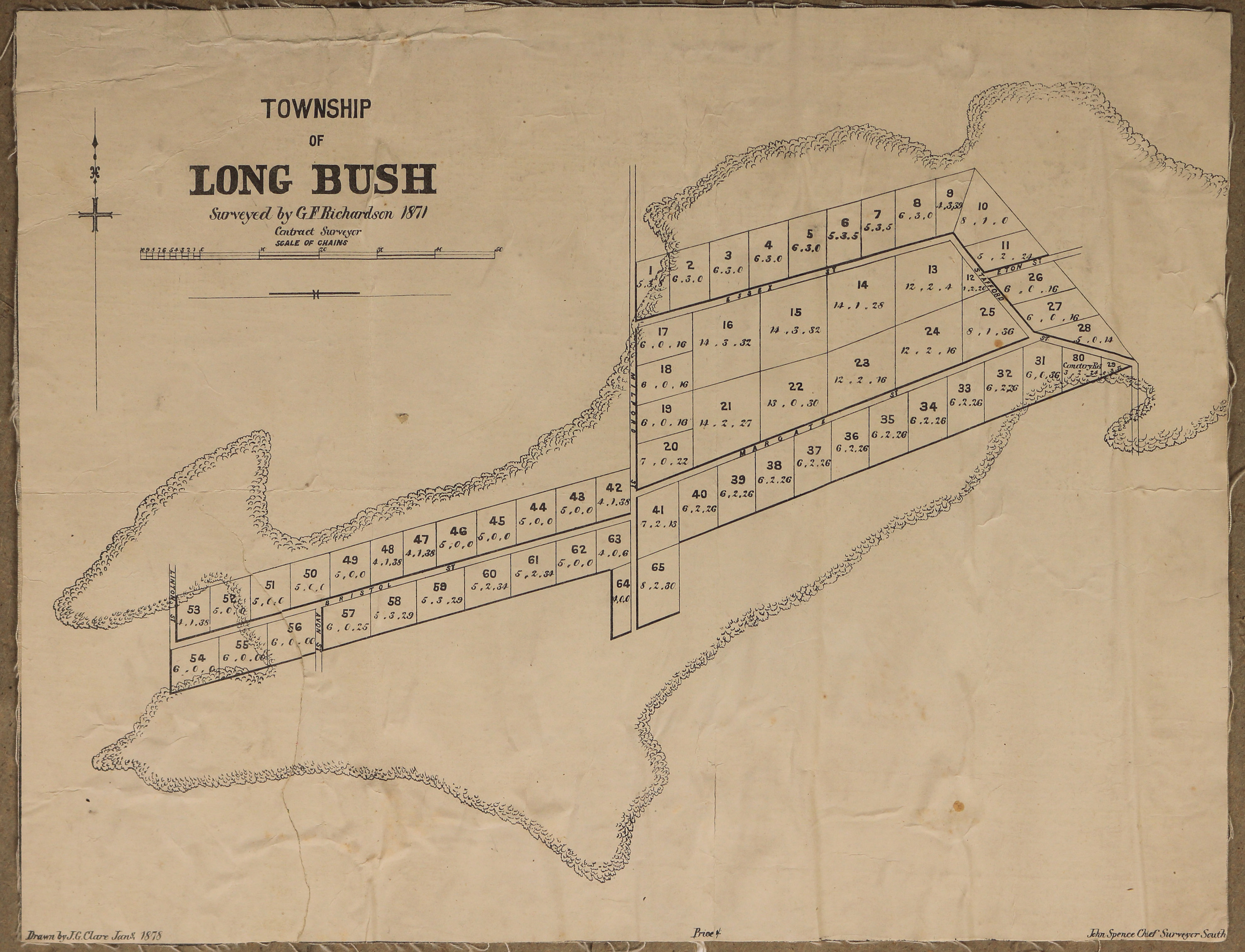
Surveyed by G.F. Richardson, Contract Surveyor, in 1871. Drawn by J.G. Clare, January, 1878.
Existence and Location of Copies
To obtain a high resolution copy of this image please contact the Archive.
Physical Description
Fabric backed paper.
Dimensions
H 265mm x W 350
Map notes
John Spence Chief Surveyor South.
Features: Essex, Margarte, Bristol, Milford, Stafford and Eton Streets.
Features: Essex, Margarte, Bristol, Milford, Stafford and Eton Streets.
Creator
- Richardson, G. F. (George Frederick) (Surveyor, Person)
- Clare, J.G. (Draftsman, Person)
Repository Details
Part of the Invercargill City Council Archives Repository
Contact:
50 Dee Street
Private Bag 90111
Invercargill Southland 9810 New Zealand
archives@icc.govt.nz
50 Dee Street
Private Bag 90111
Invercargill Southland 9810 New Zealand
archives@icc.govt.nz
