Township of Hawthorn (Seaward Bush), No Date
Component — map-box: 7
Identifier: S00100002_ag
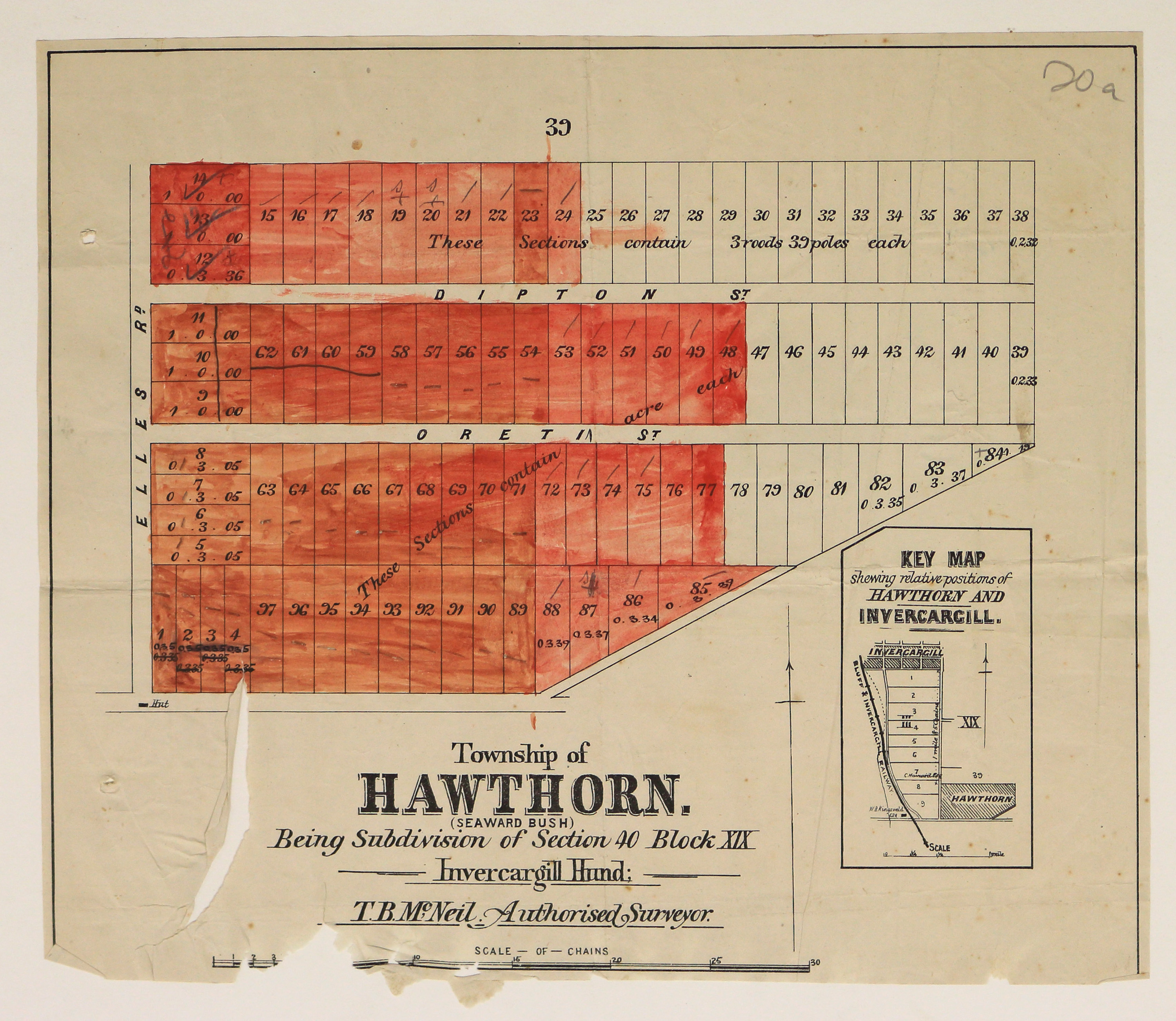
Township of Hawthorn (Seaward Bush)
Scope and Contents
From the Item:
This item contains 85 individual maps.
Dates
- No Date
Conditions Governing Use
This item has no known copyright restrictions. Please acknowledge Invercargill City Libraries and Archives, Ref: A0001 S00100002_ag, when re-using this image.
Extent
From the Series: 33 maps/plans (Map-Boxes 1 - 8 and Drawer West 6 d)
Language of Materials
English
Overview
Being Subdivision of Section 40 Block XIX Invercargill Hund; T.B. McNeil Authorised Surveyor.
Existence and Location of Copies
To obtain a high resolution copy of this image please contact the Archive.
Physical Description
Large area hand-coloured in red. Large tear, and damaged edge.
Dimensions
H 305mm x W 320mm
Map notes
Features Elles Road, Dipton and Oreti Streets.
Main map features a Hut on Elles Road. Key Map shows the relative positions of Hawthorn and Invercargill and features the names W.B. Kingsweld and C. Howard.
Main map features a Hut on Elles Road. Key Map shows the relative positions of Hawthorn and Invercargill and features the names W.B. Kingsweld and C. Howard.
Repository Details
Part of the Invercargill City Council Archives Repository
Contact:
50 Dee Street
Private Bag 90111
Invercargill Southland 9810 New Zealand
archives@icc.govt.nz
50 Dee Street
Private Bag 90111
Invercargill Southland 9810 New Zealand
archives@icc.govt.nz
