Map of Campbelltown Hundred Southland N.Z., Sept. 1914. Additions to March 1935., 1935
Component — map-box: 7
Identifier: S00100002_ay
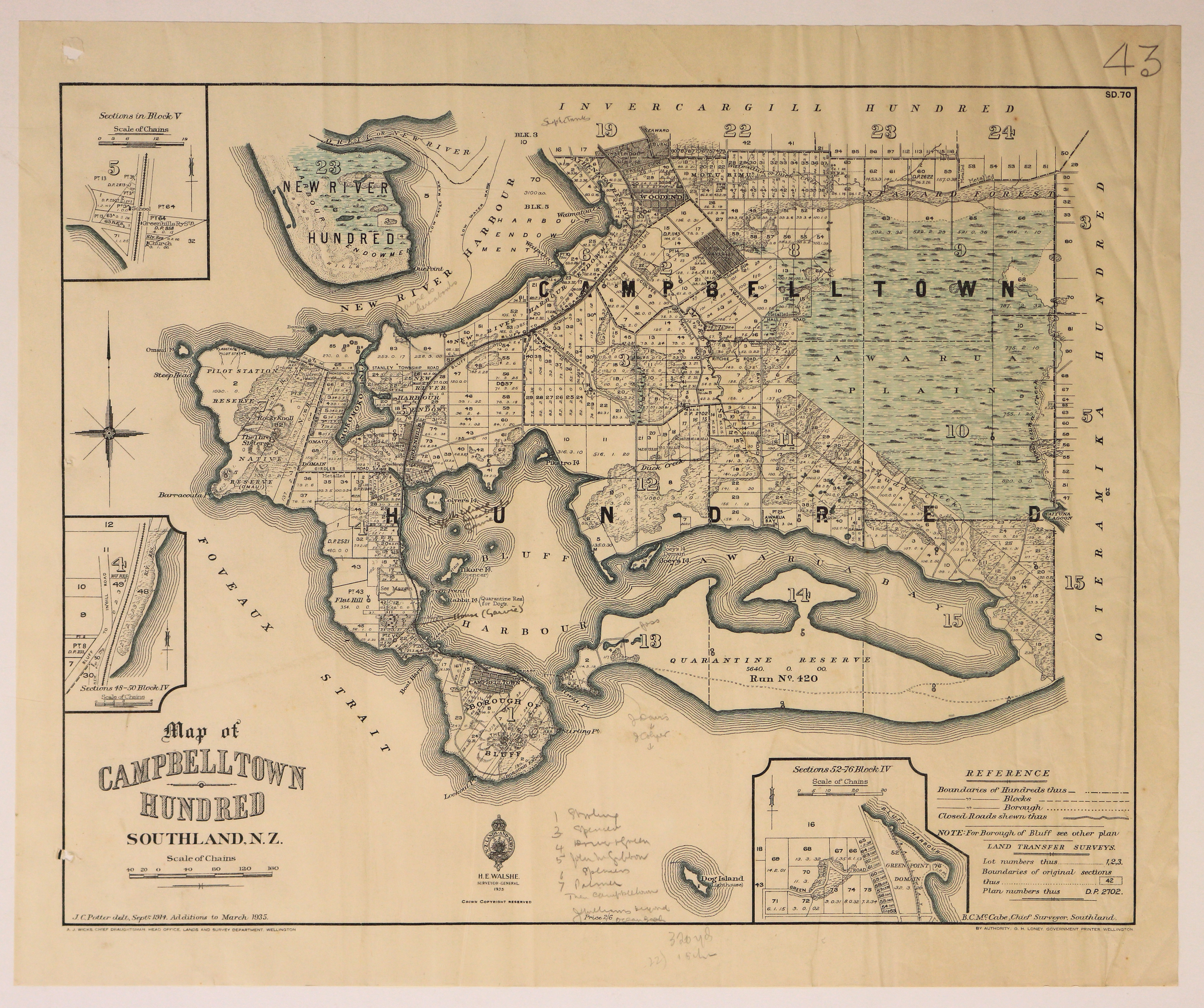
Map of Campbelltown Hundred Southland N.Z.
Scope and Contents
Map of the Campbelltown Hundred showing boundaries of Hundreds, Blocks and Boroughs.
Dates
- Sept. 1914. Additions to March 1935.
- Publication: 1935
Creator
- Potter, J.C. (James Cleghorn) (Draftsman, Person)
Conditions Governing Use
This item has no known copyright restrictions. Please reference Invercargill City Libraries and Archives A0001 S00100002_ay when re-using this image.
Extent
From the Series: 33 maps/plans (Map-Boxes 1 - 8 and Drawer West 6 d)
Language of Materials
From the Item: English
Existence and Location of Copies
To obtain a high resolution copy of this image please contact the Archive.
Physical Description
Paper.
Dimensions
H 433mm x W 480mm
Content Notes
Offical Seal of NZ Lands & Survey. H E Walshe, Surveyor General. 1935
A J Wicks, Chief Draughtsman, Lands and Survey Department Wellington.
Drawn by J C Potter, Sep 1914. Additions to 1935.
B C McCabe, Chief Surveyor, Southland.
Bordered by Foveaux Strait, Oteramika, Invercargill and New River Hundreds.
Features: Awarua Plain, New River Harbour, Bluff Harbour, Woodend, Motu Rimu, Campbelltown [Bluff], Quarantine Reserve, Awarua Bay, Waverley, Greenhills.
3 inset maps - Block V; Sections 52-76 , Block IV; Sections 48-50, Block IV.
Various hand written notes. No. 43 top right corner. SD.70.
Creator
- Potter, J.C. (James Cleghorn) (Draftsman, Person)
Repository Details
Part of the Invercargill City Council Archives Repository
Contact:
50 Dee Street
Private Bag 90111
Invercargill Southland 9810 New Zealand
archives@icc.govt.nz
50 Dee Street
Private Bag 90111
Invercargill Southland 9810 New Zealand
archives@icc.govt.nz
