Map of the Borough of Bluff Southland
Digital Image
Identifier: D00800014
Map of the Borough of Bluff Southland
Dates
- March 1907 with additions to June 1920
- 1922
Creator
- New Zealand. Department of Lands and Survey (Publisher, Organization)
Conditions Governing Use
This item has no known copyright restrictions. Please acknowledge Invercargill City Libraries and
Archives, Ref: A0010 S00800014, when re-using this image.
Extent
1 digital object : TIFF file.
Language of Materials
English
Existence and Location of Copies
To obtain a high resolution copy of this image please contact the Archive.
Physical Description
Paper on canvas. Pencil annotations.
Dimensions
766mm x 720mm
Content Notes
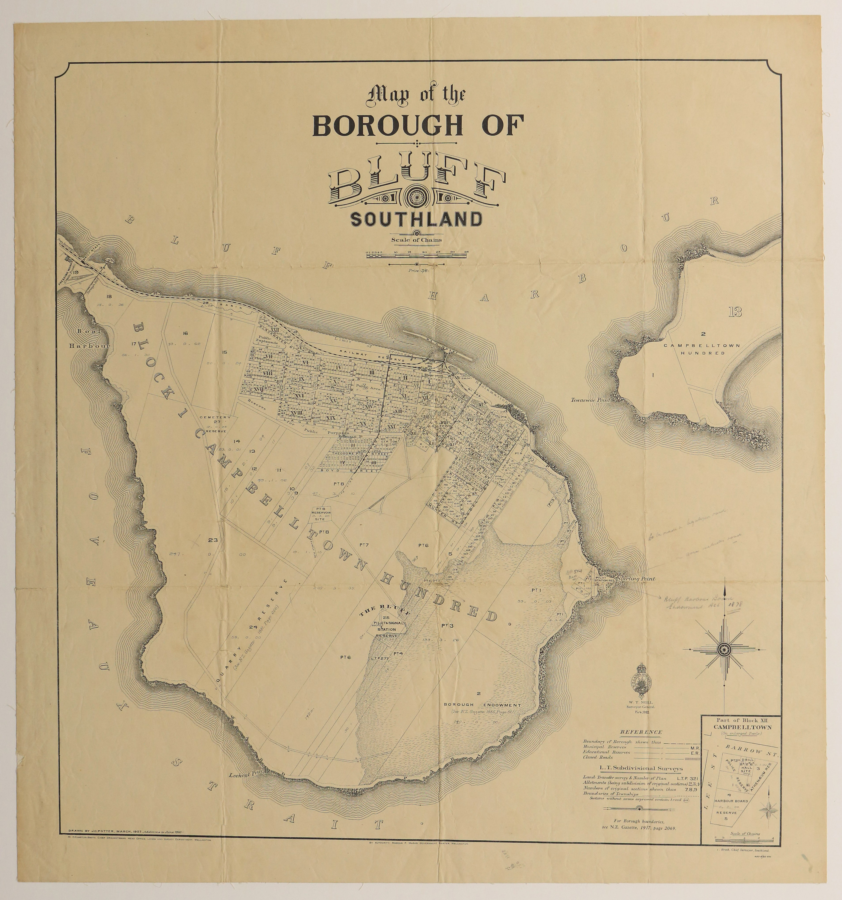
Drawn by J.C. Potter. March 1907. Additions to June 1920.
Lands and Survey Department.
Features: Block I Campbelltown Hundred, Starling [sp] Point, Proposed reclamation, wharf, inset map of Block XII, pencil annotations.
Lands and Survey Department.
Features: Block I Campbelltown Hundred, Starling [sp] Point, Proposed reclamation, wharf, inset map of Block XII, pencil annotations.
Creator
- New Zealand. Department of Lands and Survey (Publisher, Organization)
- Potter, J.C. (James Cleghorn) (Draftsman, Person)
Repository Details
Part of the Invercargill City Council Archives Repository
Contact:
50 Dee Street
Private Bag 90111
Invercargill Southland 9810 New Zealand
archives@icc.govt.nz
50 Dee Street
Private Bag 90111
Invercargill Southland 9810 New Zealand
archives@icc.govt.nz
