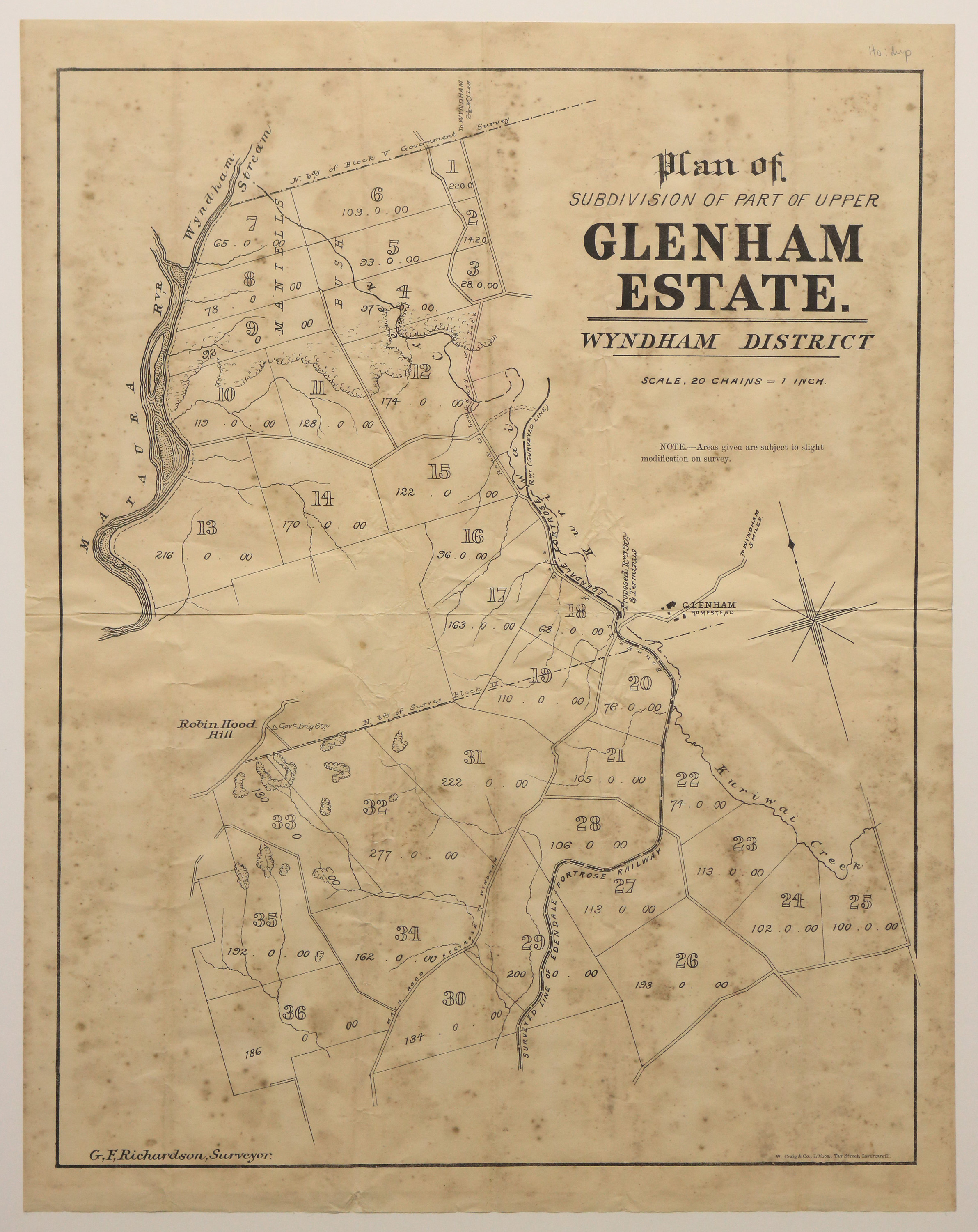
Plan of Subdivision of Part of Upper Glenham Estate, Wyndham District
Digital Image
Identifier: D00800078
Untitled
Dates
- c.1880
Creator
- Richardson, G. F. (George Frederick) (Surveyor, Person)
Conditions Governing Use
This item has no known copyright restrictions. Please acknowledge Invercargill City Libraries and
Archives, Ref: A0010 S00800078, when re-using this image.
Language of Materials
English
Existence and Location of Copies
To obtain a high resolution copy of this image please contact the Archive.
Physical Description
Paper.
Dimensions
552 mm x 433 mm
Map Notes
Surveyor, G. F. Richardson.
W. Craig & Co, Lithos, Tay street, Invercargill.
Scale of map: 20 chains = 1 inch.
Creator
- Richardson, G. F. (George Frederick) (Surveyor, Person)
Repository Details
Part of the Invercargill City Council Archives Repository
Contact:
50 Dee Street
Private Bag 90111
Invercargill Southland 9810 New Zealand
archives@icc.govt.nz
50 Dee Street
Private Bag 90111
Invercargill Southland 9810 New Zealand
archives@icc.govt.nz
