Castlemount Survey District, 1922
Component — map-box: 7
Identifier: S00100002_ba
Castlemount Survey District
Scope and Contents
From the Item:
This item contains 85 individual maps.
Dates
- 1922
Creator
- New Zealand. Department of Lands and Survey (Publisher, Organization)
Conditions Governing Use
This item has no known copyright restrictions. Please reference Invercargill City Libraries and Archives A0001 S00100002_ba when re-using this image.
Extent
From the Series: 33 maps/plans (Map-Boxes 1 - 8 and Drawer West 6 d)
Language of Materials
From the Item: English
Physical Description
Paper.
Dimensions
H 520mm x W 320mm
Content Notes
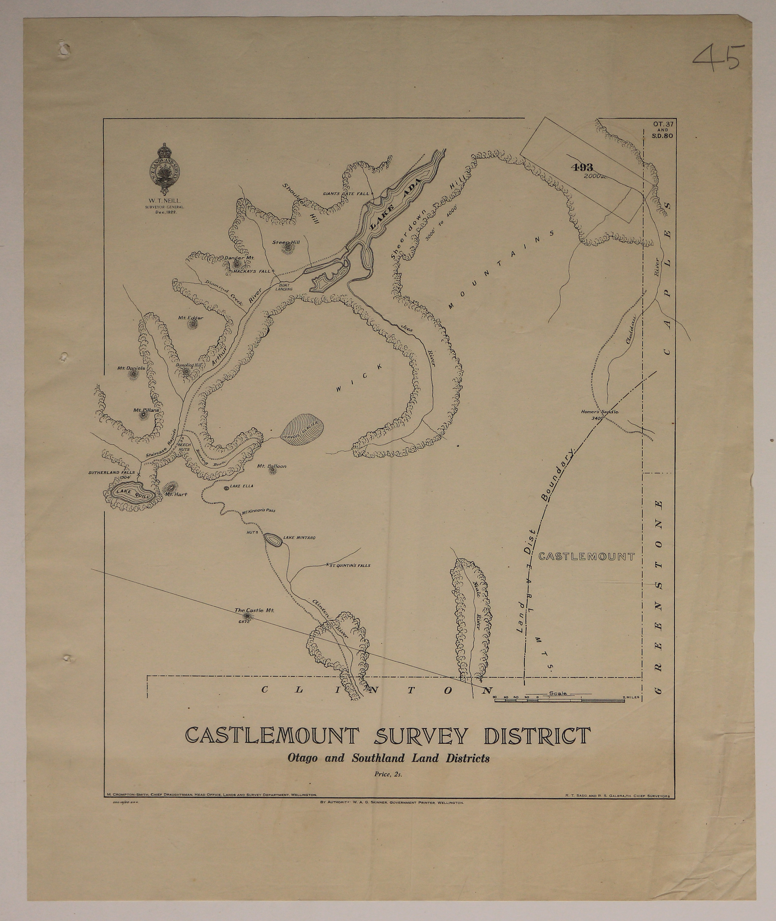
Official Seal of NZ Lands & Survey. W T Neill, Surveyor General. 1922.
M Crompton-Smith, Chief Draughtsman. Head Office, Lands and Survey Department, Wellington.
R T Sadd & R S Galbraith, Chief Surveyors.
Bounded by Clinton, Greenstone, Caples.
Featuring: Castlemount, Wick Mountains, Lake Ada, Lake Quill, Wick Mountains, Arthur River, Jess River, Clinton River, Jervois Glacier, Sutherland Falls.
OT.37 and S.D.80
Creator
- New Zealand. Department of Lands and Survey (Publisher, Organization)
Repository Details
Part of the Invercargill City Council Archives Repository
Contact:
50 Dee Street
Private Bag 90111
Invercargill Southland 9810 New Zealand
archives@icc.govt.nz
50 Dee Street
Private Bag 90111
Invercargill Southland 9810 New Zealand
archives@icc.govt.nz
