Town District of Lumsden and Part of South Lumsden
Digital Image
Identifier: D00900009
Untitled
Dates
- 1917
Creator
- Potter, J.C. (James Cleghorn) (Cartographer, Person)
Summary
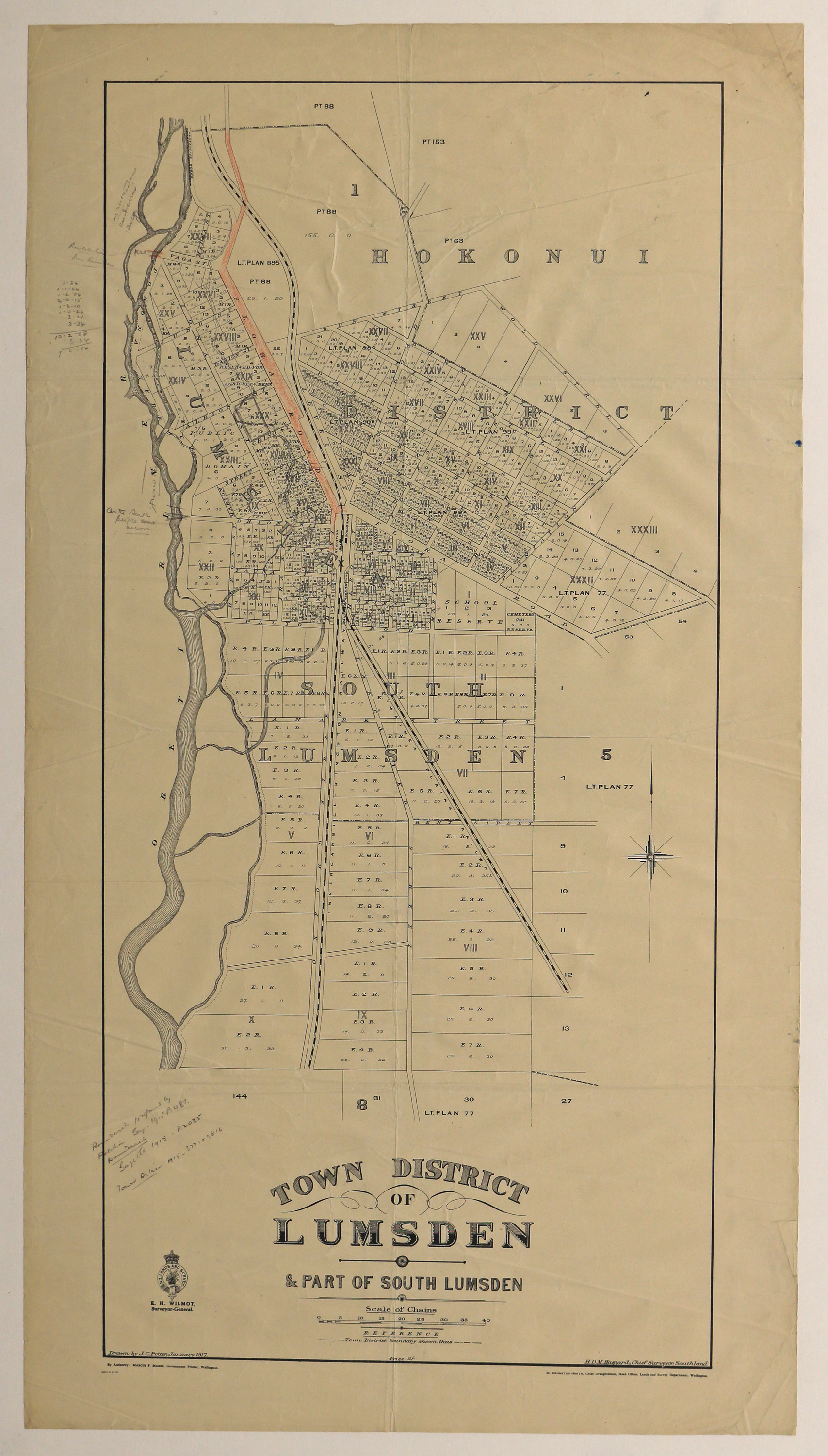
Showing part of Hokonui District, Lumsden and South Lumsden.
Conditions Governing Use
This item has no known copyright restrictions. Please acknowledge Invercargill City Libraries and Archives, Ref: A0158 S00900009, when re-using this image.
Existence and Location of Copies
To obtain a high resolution copy of this image please contact the Archive.
Physical Description
Paper
Dimensions
H 850mm x W 470mm
Map Notes
Drawn by J C Potter.
H D M Haszard, Chief Surveyor of Southland.
M Crompton-Smith, Chief Draughtsman.
E H Wilmot, Surveyor General.
Red pencil marking Flora Road. Pencil notations some of which difficult to read. Details of pricing. Pencilled detail regarding 1915 proposed boundaries and Town District for Gazette.
H D M Haszard, Chief Surveyor of Southland.
M Crompton-Smith, Chief Draughtsman.
E H Wilmot, Surveyor General.
Red pencil marking Flora Road. Pencil notations some of which difficult to read. Details of pricing. Pencilled detail regarding 1915 proposed boundaries and Town District for Gazette.
Creator
- Potter, J.C. (James Cleghorn) (Cartographer, Person)
- Haszard, H.D.M. (Henry Douglas Morpeth) (Surveyor, Person)
Repository Details
Part of the Invercargill City Council Archives Repository
Contact:
50 Dee Street
Private Bag 90111
Invercargill Southland 9810 New Zealand
archives@icc.govt.nz
50 Dee Street
Private Bag 90111
Invercargill Southland 9810 New Zealand
archives@icc.govt.nz
